The cruise: Useful Arctic Knowledge
In June, ten MSc students from the University of Bergen and the Western Norway University of Applied Science embarked on the coast guard vessel KV Svalbard to participate in the research school cruise near Svalbard, led by the Nansen Environmental and Remote Sensing Center. Their goal was to get hands-on experience during a scientific cruise in the Arctic.
Who were the participants?
The Useful Arctic Knowledge (UAK) project led by Stein Sandven (NERSC) brings together researchers and early career scientists from Norway, Canada, and the USA. This year, the research school could only be open to Norwegian residents due to COVID-19 travel restrictions.
Hanne Sagen (NERSC), assisted by Espen Storheim (NERSC), led the 2020 research school cruise. Eight master students from the University of Bergen (UiB) within the earth science, geophysics, and informatics study programs, and two master students from the Western Norway University of Applied Sciences (HVL), attended the research school. In addition to Sagen and Storheim, five researchers and PhD candidates from UiB and HVL joined the KV Svalbard crew onboard as instructors. The KV Svalbard was the first Norwegian vessel to reach the North Pole during the CAATEX cruise in 2019, and NERSC researchers have been onboard to conduct research in the Arctic several times already.

Photo: Hanne Sagen, NERSC
What was the aim of the research school cruise?
The students got the opportunity to participate in a scientific cruise and learn how to collect various measurements and metadata, how to pre-process different kinds of data, and how to set up a plan for data management. They will be able to apply many of these newly acquired skills during their own MSc projects and other future research projects.
What was done?
The research cruise started on the 20th of June in Tromsø, and the KV Svalbard headed for the Svalbard archipelago north of 76°N. During the three-day transit, the researchers gave lectures on oceanography, underwater acoustics, marine optics, natural hazards, and seismology, as well as the different instruments and methods to prepare the students for their upcoming tasks. Upon arrival in Storfjorden in the southern Svalbard region, the hands-on experience began:
CTD and water samples
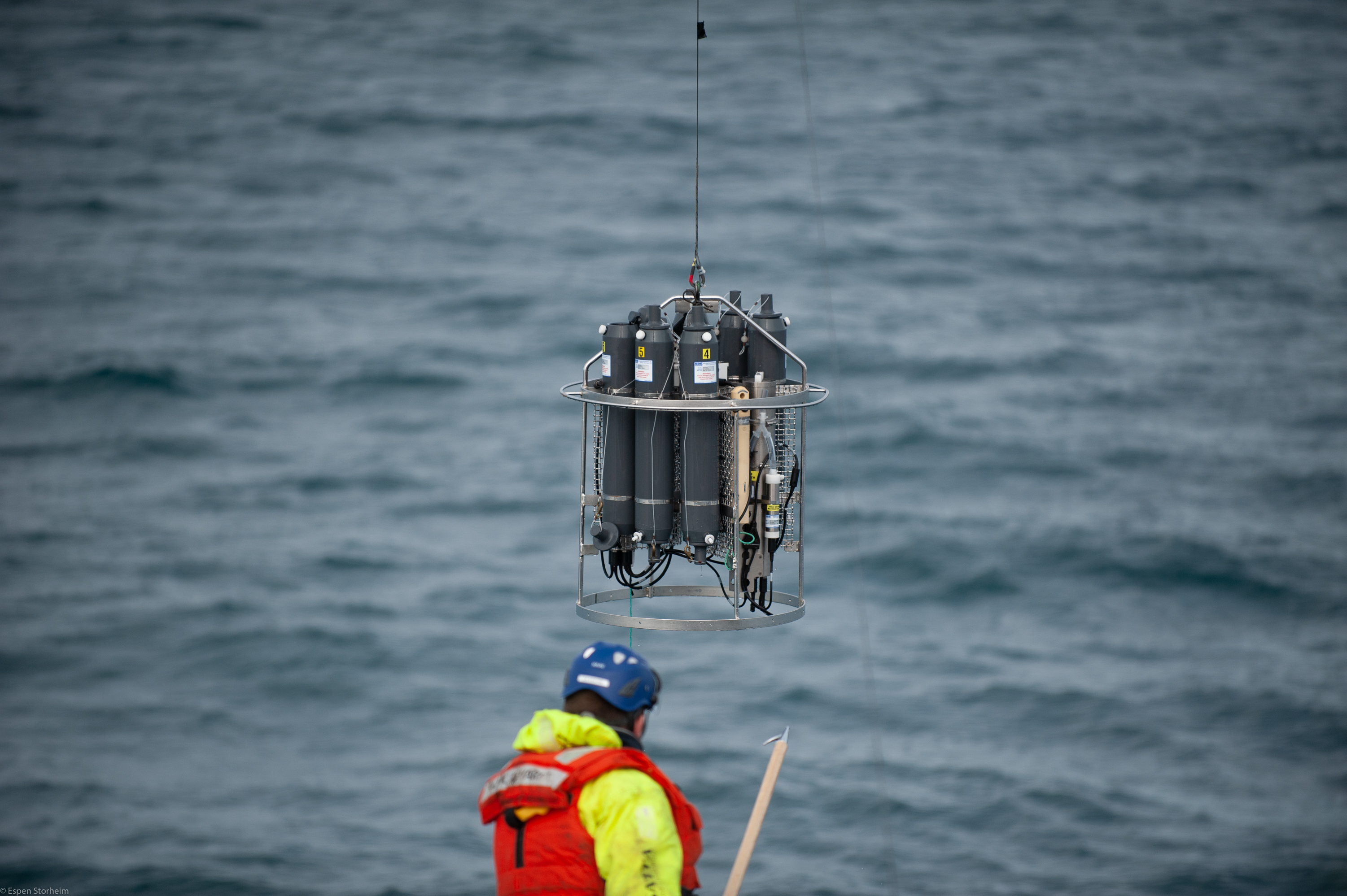
Photo: Espen Storheim
CTD stands for conductivity-temperature-depth, and these three parameters are used to get important information about the ocean, from the sea surface almost down to the seafloor. Conductivity gives us an accurate way to calculate the salinity of the water. Three different sensors for the parameters are attached to a frame that also holds water sampling bottles. The setup is lowered into the water on a long steel cable, and the CTD information is taken on its way down. On the way up, the water sampling bottles can be opened and closed at depths of interest, to take water samples at different depths. In the Storfjorden area, the water is quite shallow, but the measurements can be taken down to several km water depths.
The students participated in the preparation and operation of the instrument to take CTD and water samples at 26 different locations in Storfjorden, to create cross-sections of the fjord area.
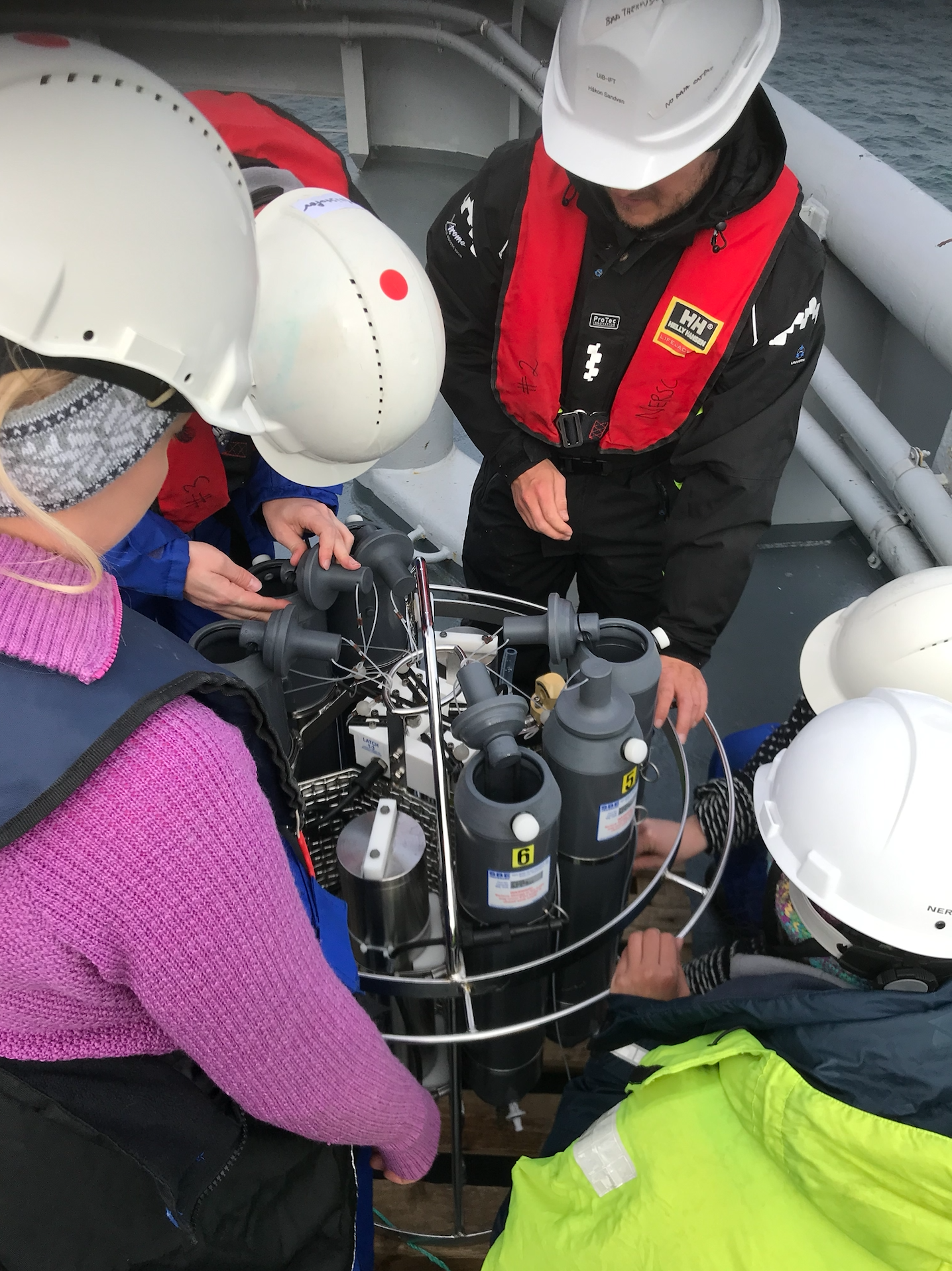
Photo: Hanne Sagen, NERSC
Marine optics
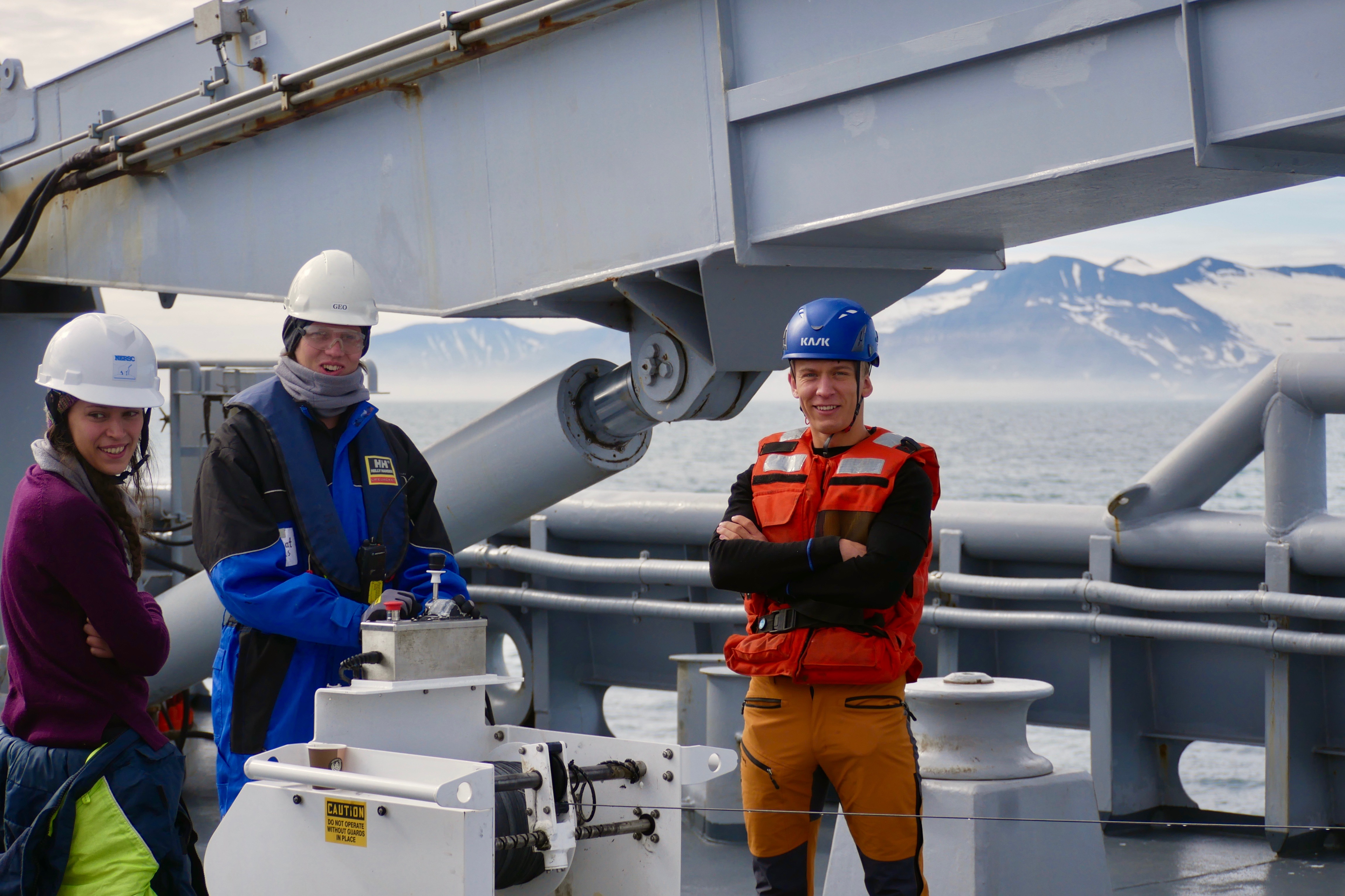
Photo: Håkon Sandven, UiB
In marine optics, light properties of ocean water are studied. Different particles and organisms in the water affect how light is absorbed and scattered in the water, and by observing light being sent through a water sample, researchers can infer the amount and type of particles in it. Storfjorden is an interesting venue for these measurements due to coastal waters, with significant glacial meltwater, meeting the Barents Sea water masses. During the oceanographic sections with the CTD, both in-situ optical measurements (instruments lowered deep to the ocean floor while measuring) and water samples were collected in addition.
The water samples, taken during the CTD casts, were supporting the in-situ instruments, as well as being the subject of more detailed laboratory studies. The students got to conduct the light measurements from the deck of KV Svalbard, right after retrieving the water samples from different depths. They also participated in the water sample filtration and preparation process, as well as on-ship maintenance of the in-situ instruments. This part of the research school gave the students a good insight into the potential, but also limitations and pitfalls of optical measurements in the marine environment, and how they are connected to the more commonly used remote sensing observations.
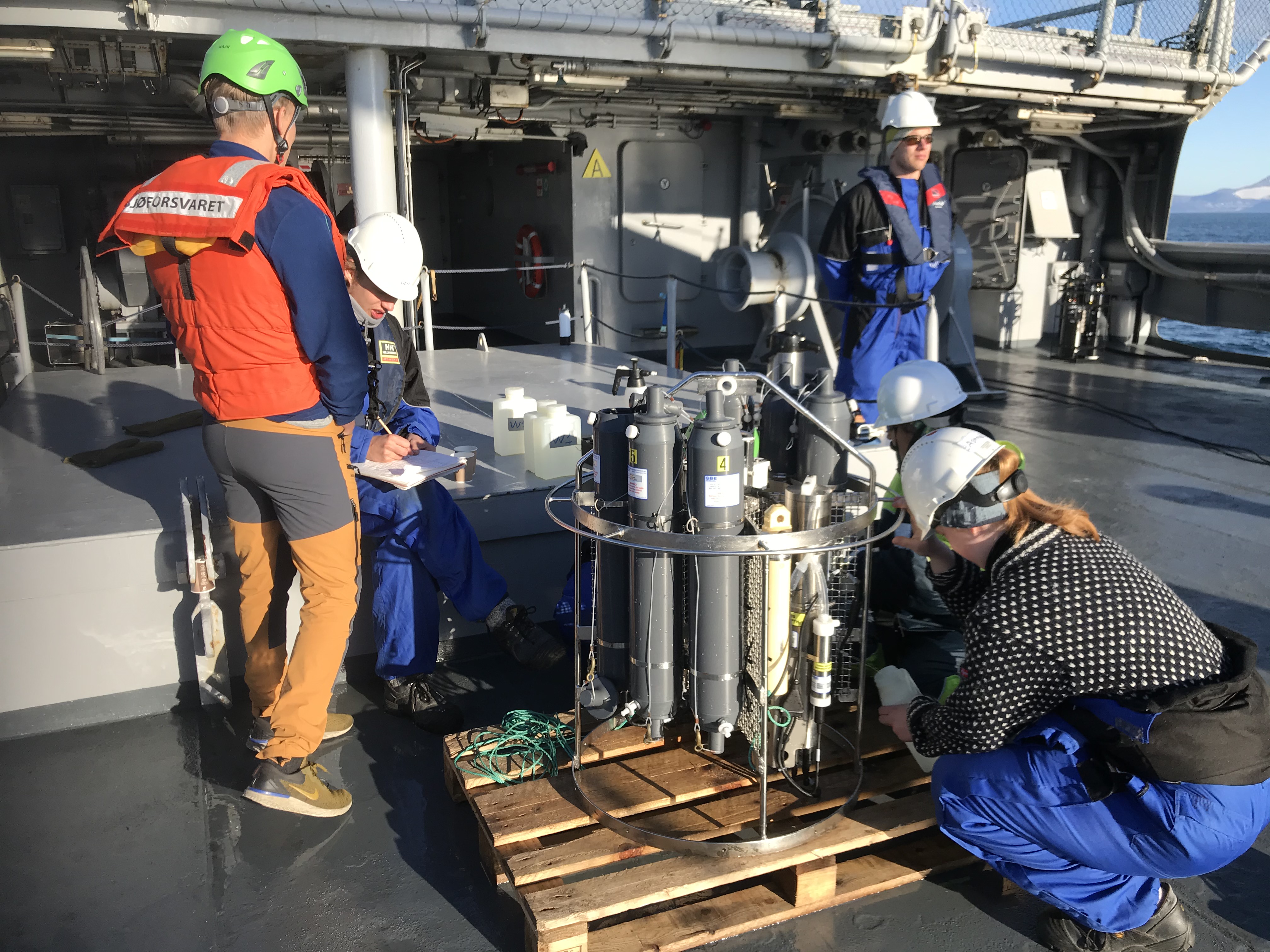
Photo: Hanne Sagen, NERSC
Underwater Acoustics
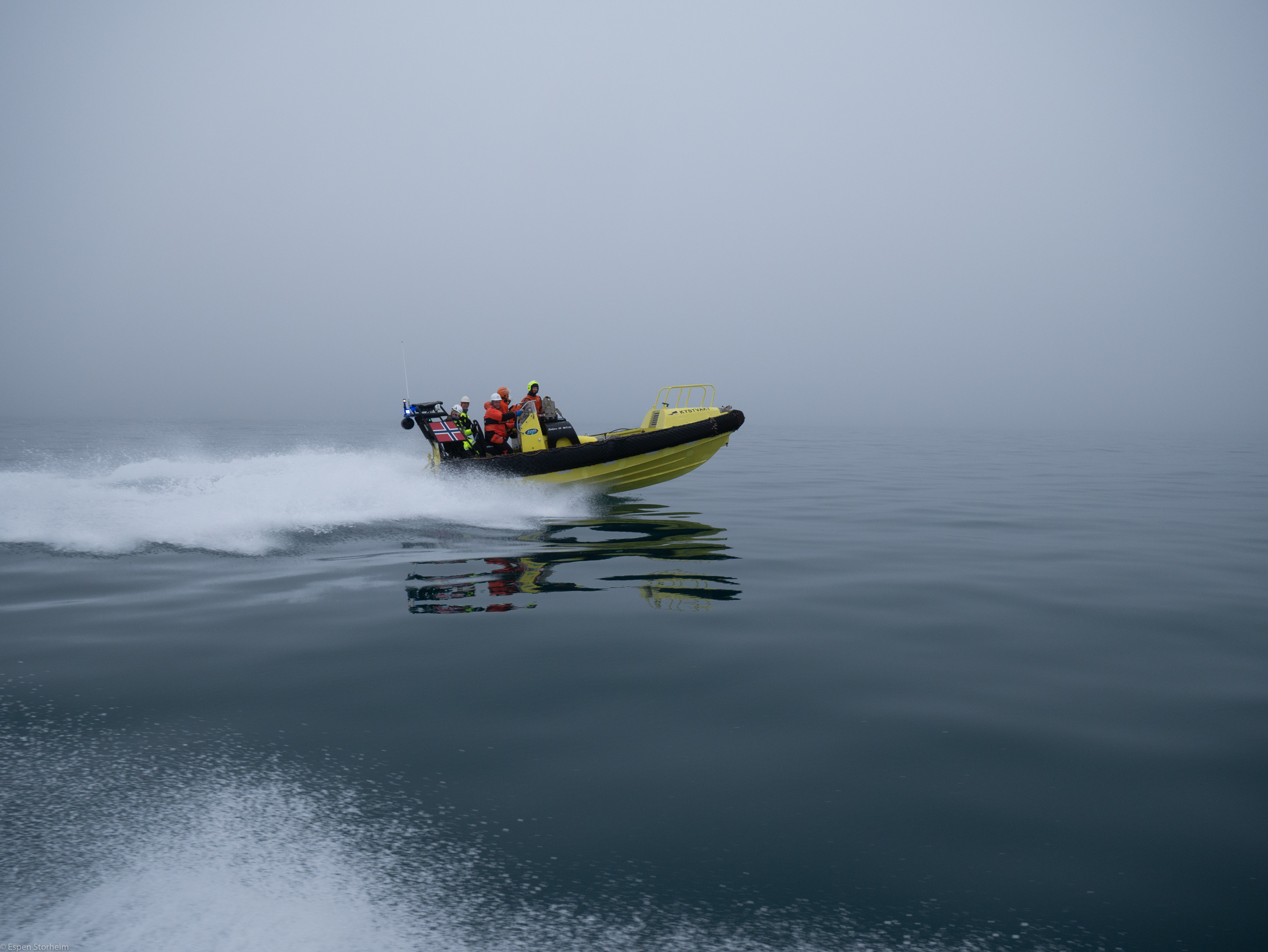
Photo: Espen Storheim, NERSC
Aside from looking at water samples directly, researchers can make use of acoustics to gather information about the ocean, and the cruise participants learned about the possibilities. The students actively conducted underwater acoustic experiments. Two types of underwater acoustic experiments happened during the research cruise: Passive acoustics and active acoustics. For both types, the students got to go on small boats to be close to the water surface for instrument deployment and far away from KV Svalbard to reduce acoustic noise from the vessel.
Passive acoustics: One group of students was sent out in a boat with hydrophones (acoustic receivers), and they listened passively to sounds below the sea surface. The students got to record the sounds of icebergs breaking off a nearby glacier and animals nearby.
Active acoustics: Two student groups on two different boats worked together by sending acoustic signals from one boat to the other. They increased the distance between boats in order investigate how the sound transmission changes. Different source and receiver depths were also tested.
The students learned about the use of these acoustic experiments and how to handle and process the obtained data.
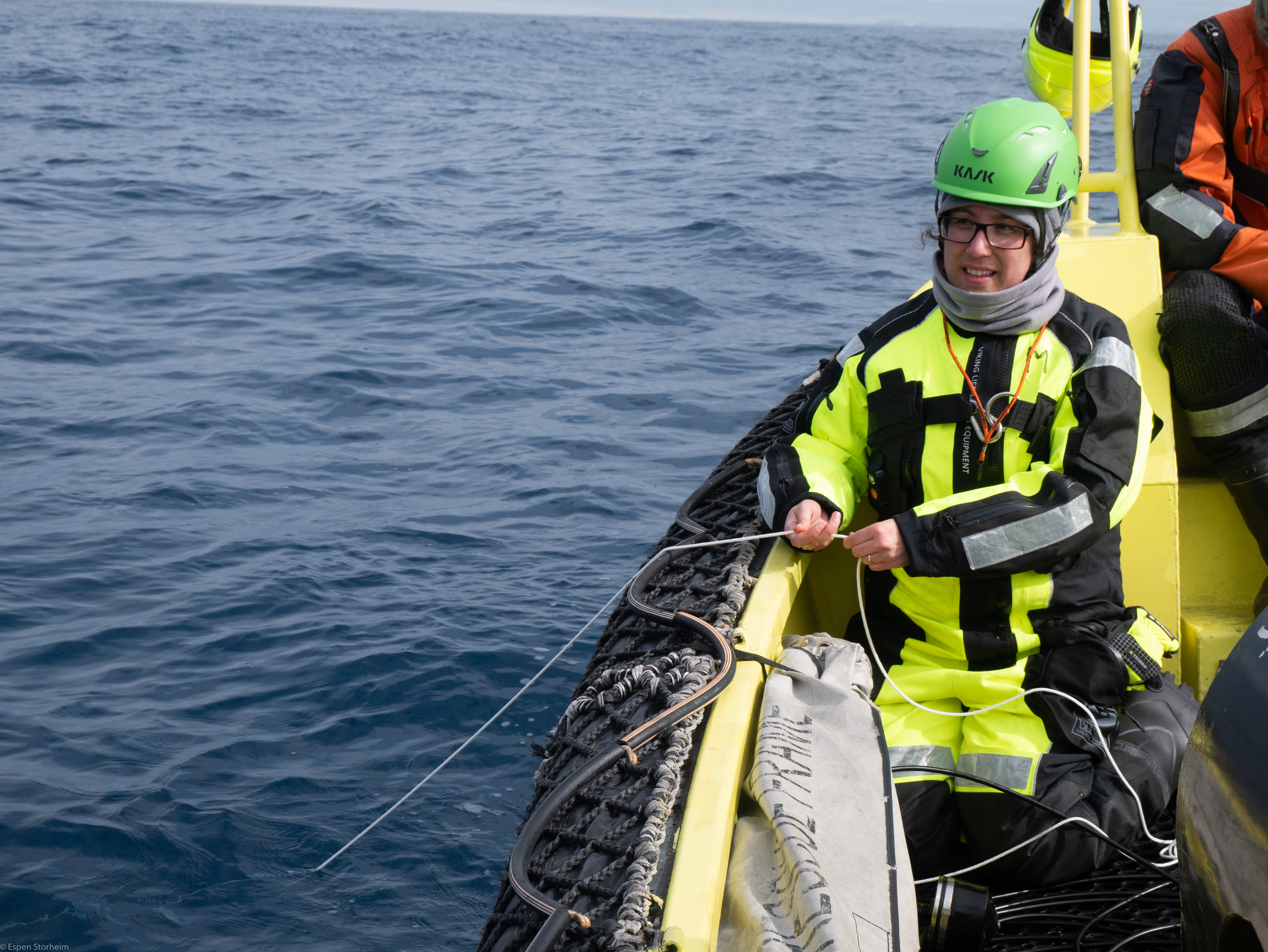
Photo: Espen Storheim, NERSC
Ocean Bottom Seismograph Recovery

Photo: Espen Storheim, NERSC
Another part of the hands-on scientific work for the students was the recovery of Ocean Bottom Seismographs (OBS). In 2008, a magnitude (Mw) 6.1 earthquake occurred in the area. The increased seismic activity was studied only by land stations on Svalbard and mainland Norway. In order to monitor and study the ongoing seismic activity in Storfjorden closely, three OBS instruments were set out onto the sea floor in summer 2019. To collect the data, the OBS need to be recovered from the sea floor. This happens through sending a release command, and the instrument floats to the sea surface and can be picked up. During the research school cruise, the students got to be involved in the recovery process of two out of three OBS.
Data Processing
The students learned how to set up a data management plan and got first-hand experience with including processing various datasets collected during the cruise and the importance of securing metadata. With a data management plan in place, they learned about how to share data in a proper way. They also learned how data sharing will give a better understanding of oceanography, marine optics, underwater acoustics, and seismic activities in an area.
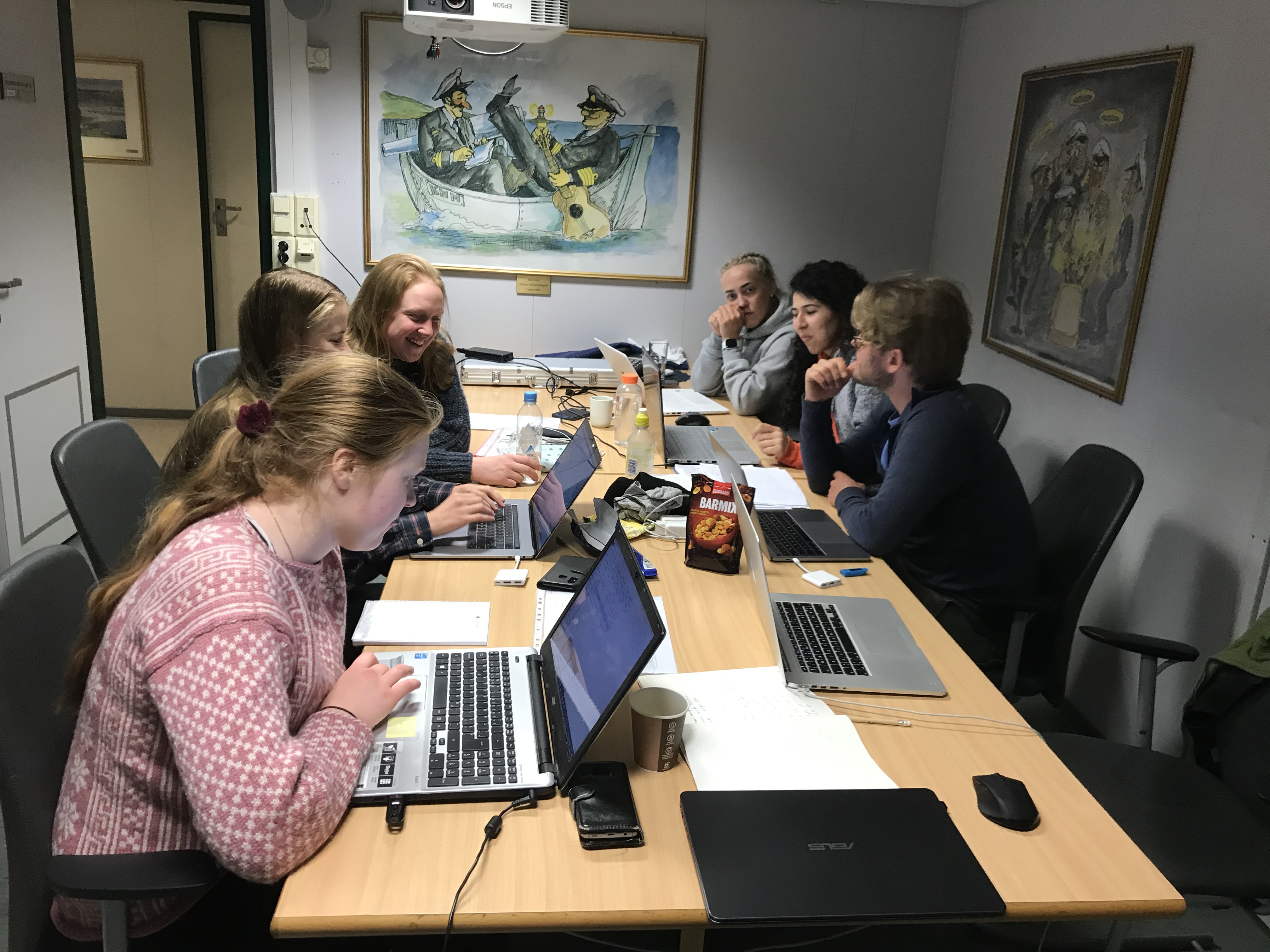
Photo: Hanne Sagen, NERSC
What happened after data collection and processing?

KV Svalbard set sail for Tromsø, but one intermediate stop happened at Bjørnøya, the southernmost island belonging to the Svalbard archipelago, halfway between Spitzbergen and the northernmost part of mainland Norway. Here, the students and researchers went on an expedition and some even bathed in the 2,7 °C cold ocean water! On the transit back to mainland Norway, the students got to present the scientific results of their work to the KV Svalbard crew and practice their communication skills. After 10 days onboard, the ship arrived in Tromsø on the 30th of June, and the students finished the trip with a whole lot of new knowledge, valuable skills, and unforgettable impressions from Arctic research cruise field work that they can benefit from in the future.
Funding and Project Partners

Useful Arctic Knowledge - Partnership for Research and Education (UAK) is funded by the International Partnerships for Excellent Education, Research and Innovation (INTPART) program 2018 – 2020 (contract nr. 274891), which itself is funded by the Research Council of Norway and the Norwegian Centre for International Cooperation in Education.
The research school cruise is also part of the H2020 Integrated Arctic Observation System (INTAROS) project (contract nr. 727890).
UAK is led by the Nansen Environmental and Remote Sensing Center and has project partners in Norway, Canada, and the USA:
University in Bergen, Department of Earth Science
Western Norway University of Applied Sciences
Norwegian Meteorological Institute
University of Manitoba, CA
University of Calgary, CA
University of Colorado, USA